|
Aron's Photography from....
|
|
Aron's Photography from....
|
|
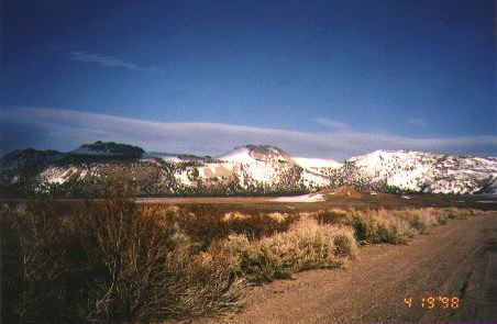
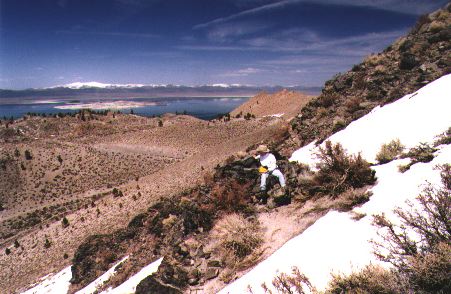
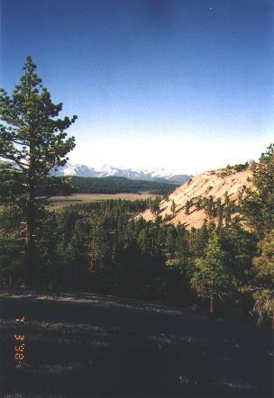
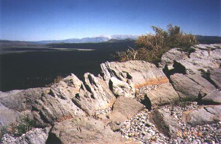
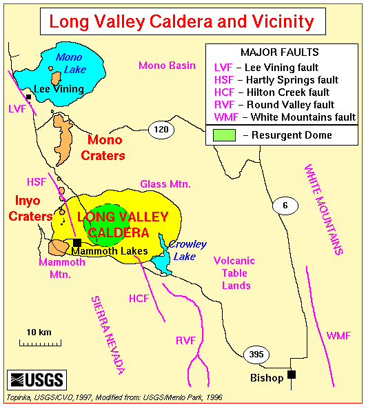
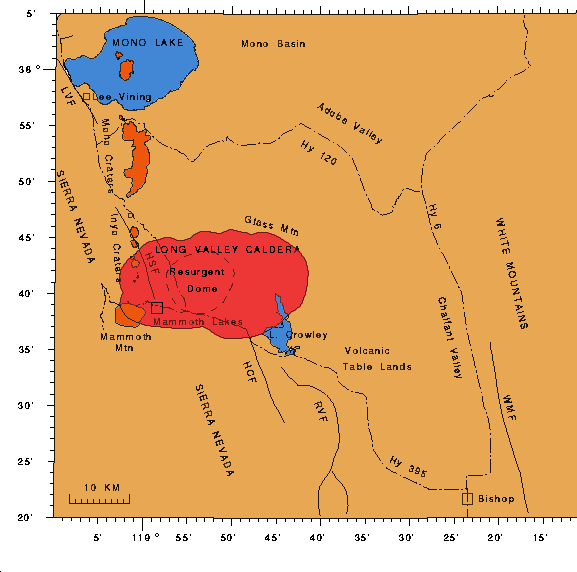
The Mono Craters comprise a young volcanic chain associated with the Long Valley caldera in eastern-central California. Mono Craters are part of a larger structure that includes the Inyo Craters to the south and the volcanoes of Mono Lake to the north, which together form a 40-km-long chain of Late Pleistocene and Holocene craters, domes, and flows. Mono Craters lie just south of Mono Lake, and can be easily viewed from the lake, as well as from Highways 395 and 120. The entire Long Valley caldera complex marks the western rim of the Great Basin and Range province of North America, and it is associated with extensional tectonism -- that is, the land is slowly being stretched apart. Although the region has not seen volcanic eruption during historic times, Mono Craters last erupted around 1350 A.D., and as recently as 250 years ago, Paoha Island in Mono Lake experienced a small eruption. During the summer of 1998, I worked on a research project which involved digging a series of pits through volcanic deposits and analyzing data we collected; more information is available on my research page. This page features photos taken in the field while working on that project, as well as others taken during previous trips. The background on this page shows a portion of the stratigraphy visible in one of the pits; these beds represent only a small part of the overall eruptive sequence of the 610 A.D.eruption, the one in particular we studied. All the beds of that eruption (several meters' worth) were probably laid down over the course of only a few days to a few weeks! View newest pictures, taken August 1998. |
Mono Craters, by Air
|
|
|
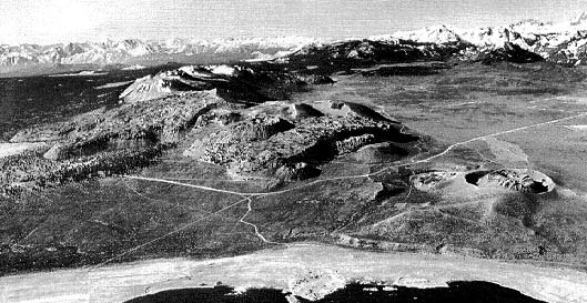
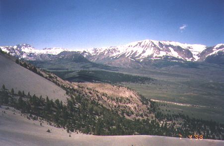
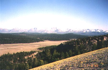
Above: View of Mono Craters, looking south from over Mono Lake. Panum Crater is distinctly visible as the circular crater standing alone (neareast the lake) on the right. Note that Hwy. 120 is forced to bend around the bulk of Mono Craters. (It crosses the craters through the gap just south of Panum.) |
October 1997
|
1 |
2 |
|
3 |
4 |
|
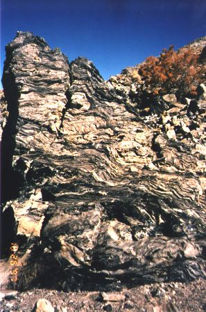
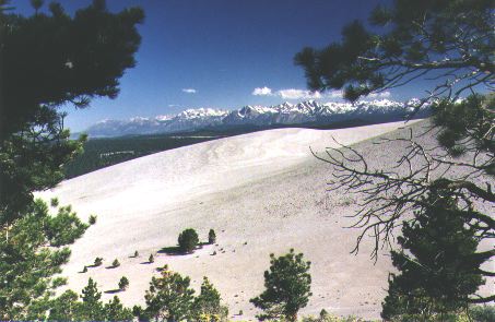
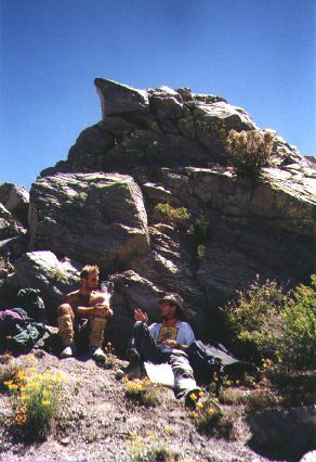
(Photo 1) A photo of the line of domes comprising the Mono volcanic chain, looking south from the rim (tephra ring) of Panum Crater. (Photo 2) A photo of the tephra ring of Panum Crater, taken from within the crater, with the Sierra Nevada mountains in the background. Panum Crater is a classic example of an explosion pit in which the subsequent lava plug (Photo 4, right) was not large enough to completely fill the initial tephra ring (Photo 4, left). The rock observed here is mostly rhylolite. Photo 3 shows an excellent example of flow bands of obsidian and pumice in the rhyolite. |
April 1998
|
In April, we had not yet begun our summer research project, and Kerry Sieh (the Prof I am working with) and I went up to Mono Craters to get some samples and take care of other business matters. During this trip, we were working along the western side of the craters -- Photos 5-11 are from that side. |
|
5 |
6 |
7 |
|
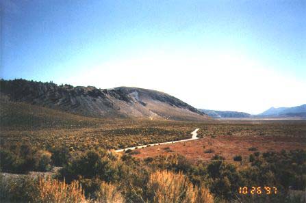
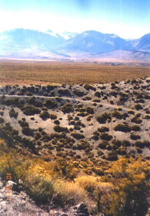
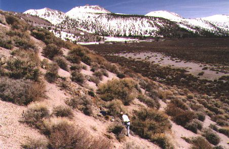
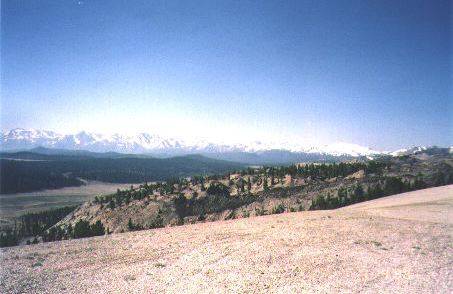
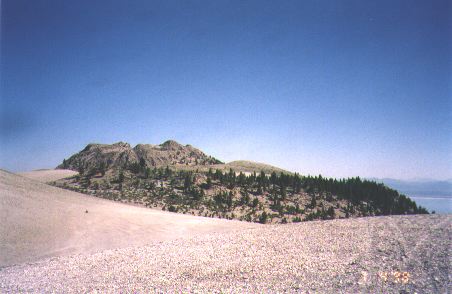
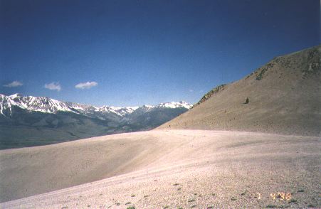
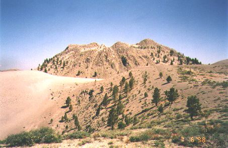
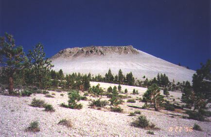
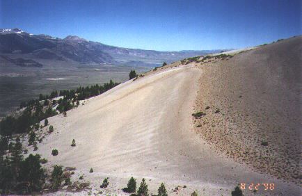
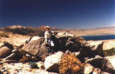
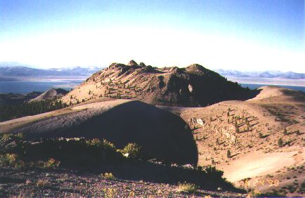
(5) A view of Mono Craters from the west. The three peaks in the photo -- all of them volcanic vents -- are, from left to right (from north to south), Crater Mountain, "Dome 20," and South Coulee. Crater Mountain, the tallest of the chain, rises 2000 feet to the 9172-foot level from the floor of Pumice Valley below. (6) That's me, taking a break from field work for a photo. Mono Lake is visible in the background. (7) North Coulee, with "Dome 15" off to the right. The deposits on that "smooth," distinctly gray slope are so porous that they cannot retain water, and nothing has been able to grow there. Kerry's back is in the foreground. |
||
|
8 |
9 |
|
(8) Hey! Kerry snuck a picture of me getting some supplies out ... at least I think that's what I'm doing! But it's another great shot of "Dome 15," Crater Mountain, "Dome 20," and South Coulee, so I had to include it. (9) Another great shot of Kerry's, with me preparing to take notes at our latest sample site. Mono Lake and Paoha Island are visible in the distance. |
|
|
10 |
11 |
|
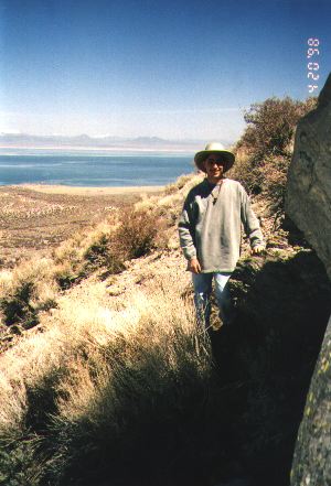
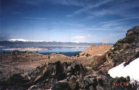
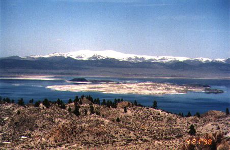
(10) My picture, from that sample site. Again, Mono Lake and Paoha Island are visible in the distance. (11) A zoom-in of Mono Lake. This is a great shot of Paoha and Negit Islands and Black Point. Paoha, the light-colored island which is nearest the camera, consists primarily of lake-floor sediments that were uplifted when magma got close to the surface in the past, perhaps only a few hundred years ago. The dark island behind Paoha is Negit, a basaltic cinder cone which formed about 1400 years ago. Black Point sits on the north shore of Mono Lake (on the left in the distance) and consists of a series of subaqueous basaltic lava flows emplaced about 14,000 years B.P. |
|
|
|
|
|
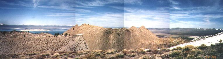
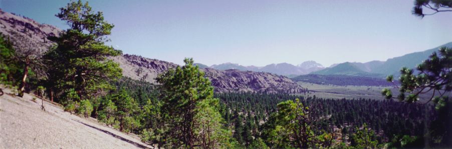
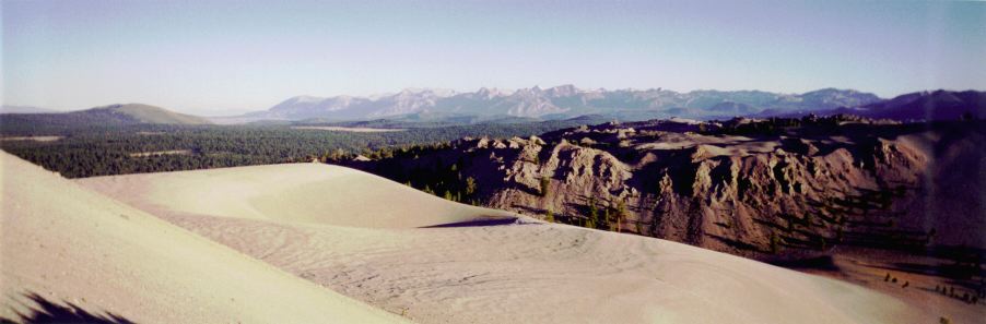
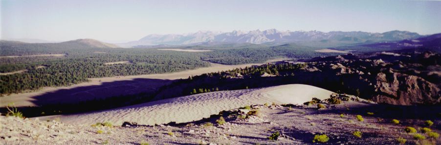
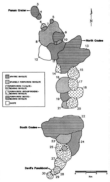
Panorama: The panorama on this page is cropped, and centers on "Dome 9." Mono Lake and part of "Dome 8" are visible on the left, and the valley east of the craters is visible on the right. If you click on the panorama, you will get an even wider panorama, which includes all of "Dome 8" and Mono Lake, as well as the town of Lee Vining, Pumice Valley, and the steep escarpment of the eastern Sierran range front. The panorama was taken from the north side of "Dome 11" and spans over 150 degrees of view, looking due west on the left, north in the center, and almost due east at the right. See regional index map or alternate version, or see map of dome numbers. |
|
July 1998
|
In July, Kerry Sieh, Matt Dawson (another student), and I spent time on the eastern side of Mono Craters. These photos were taken there and reflect both scenery we saw and the geology we "did." We went back in August, and those photos are below. |
|
12 |
|||
|
13 |
14 |
||
|
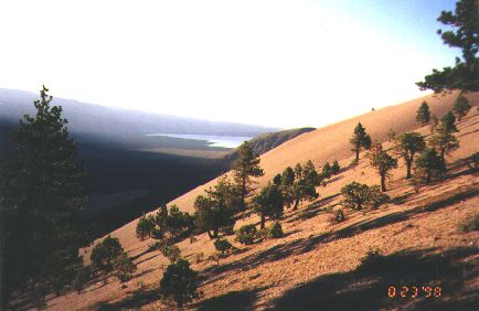
(12-13) Views of South Coulee looking south from the east side of "Dome 20." The mountains in the distance are the Sierras, marking the south rim of the Long Valley caldera. (The Mono Craters are north of the caldera.) (14) View from the same spot as Photo 13, looking north toward Crater Mountain. |
|||
|
15 |
16 |
17 |
|
(15) View (looking south) of an explostion pit south of "Dome 20." South Coulee is behind the pit, and the south rim of Long Valley caldera is visible on the left in the distance. (16) View (looking southwest from the same location) over the explosion pit, looking at a flow off South Coulee. South Coulee is to the left, Pumice Valley to the right, and snowy peaks in the distance are part of the Sierra Nevadas. (17) View (looking west from the same location) of the explosion pit. "Dome 20" is to the right, and the Sierras are in the distance. |
||
|
18 |
|
(18) A view of Crater Mountain from the south, with another explosion pit on the left. |
|
19 |
20 |
|
(19) View from "Dome 18," over the eastern side of "Dome 20," toward the south rim of Long Valley caldera. (20) View from the eastern side of "Dome 20," toward the south rim of Long Valley caldera. South Coulee is in the middle on the right, and the Eastern Craters Sand Flat is in the middle on the left. The yellow flowers in the foreground stand out in the late afternoon sun. |
|
|
21 |
22 |
|
(21) Ah, the day's over at last! -- leaving one of our pits after a hard (but very worthwhile) day of digging, and ... (22) returning to camp, anticipating a delicious dinner which followed. Mmm, was it good! |
|
|
23 |
24 |
|
(23) Matt taking his turn at digging the pit. (24) View of the stratigraphy inside one of the pits. This photo shows 90 cm of the wall of the pit; the entire pit was roughly 2.5 m deep. All the beds shown in the photo were laid down in a matter of days to weeks during the 610 A.D. eruption of the Mono Craters. |
|
August 1998
|
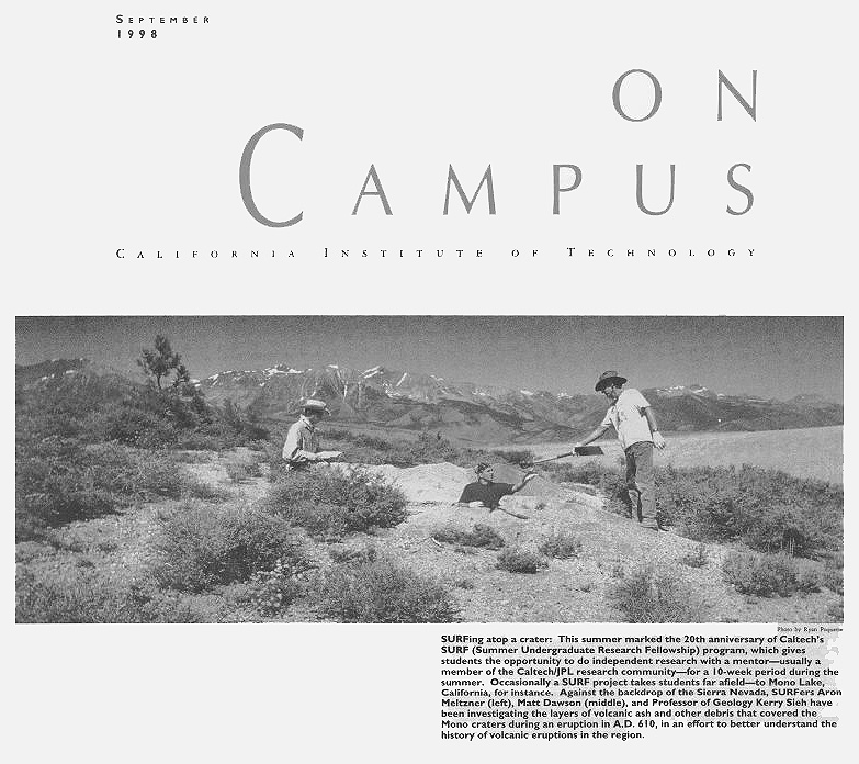
And back we went.... I decided at the last minute to also bring a throw-away panorama camera, and I'm glad I did -- some of those photos are included below. We were joined for a day by Ryan Poquette, photographer and writer for Caltech News and On Campus. Apparently, our SURF is quite photogenic, as we made the cover of On Campus for September, and we'll also be featured in the next issue of Caltech News, expected out in early November. Some of the photos Ryan took of us, including a color version of the On Campus photo, are here. |
|
25 |
26 |
|
(25) View of "Dome 20" from the west. (26) View looking north from the northern side of "Dome 20." The banding seen in this photo is created by the surface outcrop pattern of the same beds we are logging in the pits. This is an erosional surface: the beds were deposited on top of an older tephra ring, but the upper layers were "sliced" away by erosion, leaving the exposure we see here. |
|
|
27 |
28 |
|
(27) Swale between South Coulee and an explosion pit to the north; looking west, toward the Sierras. (28) A couple of volcanic bombs, which cracked and fell apart upon impact. |
|
|
29 |
|
(29) A view (looking north) of Crater Mountain from atop "Dome 20." Negit and Paoha Islands can be seen in Mono Lake, just to the left of Crater Mountain. |
|
30 |
|
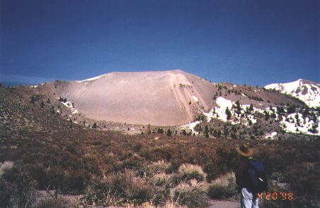
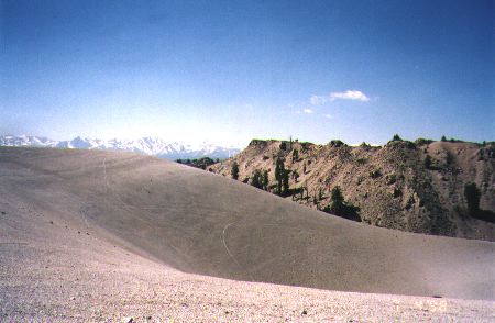
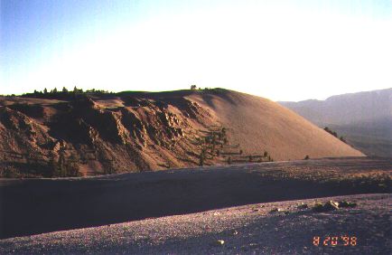
(30) A view (looking south) of the pyroclastic flow off to the west of South Coulee. This ~100-meter-high flow is associated with the 610 A.D. eruption. Again, see map. |
|
31 |
32 |
|
(31) That's me, taking a break from digging to pose for a photo. (32) This is a photo Kerry took of the rock outcrop behind me, but he wanted a human in the photo for scale, and to point to the place we sampled from. But hey, it's a rare great shot of me.... This is atop "Dome 20." |
|
|
33 |
|
(33) A view (looking south) toward South Coulee from atop "Dome 20." An explosion pit is visible in front of the coulee, and the mountains in the distance are the Sierran range front that make up the south rim of Long Valley caldera. |
|
34 |
|
(34) Another view looking south from atop "Dome 20." The "ripples" on the hill in the foreground are erosion patterns, in which a lighter-colored underlying layer and a darker overlying layer are alternatingly at the surface. The south rim of the caldera is again visible in the distance. |
|
35 |
36 |
|
(35) Wind fluting in the rocks. Wind from the same predominant direction over time has sand-blasted these patterns into the rocks. View is looking east from atop "Dome 20." Boundary Peak, which straddles the California-Nevada border, is the white peak on the horizon. (36) Matt and Kerry eating lunch; behind them is an outcrop of dome rock that exhibits beautiful breadcrusting. |
|
|
37 |
|
(37) View (looking south) of an explostion pit south of "Dome 20." South Coulee is behind the pit on the right. |
|
38 |
39 |
40 |
|
(38) View looking north, with Mono Lake in the distance. (39) A view of Crater Mountain from the south, with an explosion pit in front. (40) View (looking south) toward South Coulee. All three shots were taken in the late afternoon. |
||
|
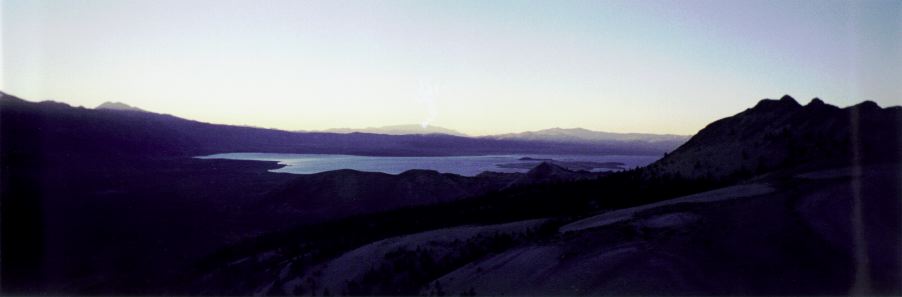
41 |
|
(41) Mono Lake appears almost to glow minutes after the sun had set behind the Sierras to the west. |
Visit the Spatial Interpretation Lab, my office for the summer when I was not in the field.
*** Back to the Photography Front Page or Back to my Home Page. ***
This page maintained by Aron Meltzner.
Initiated 11 August 1998.
Last modified 27 October 1998.


